 Catalogue des ressources
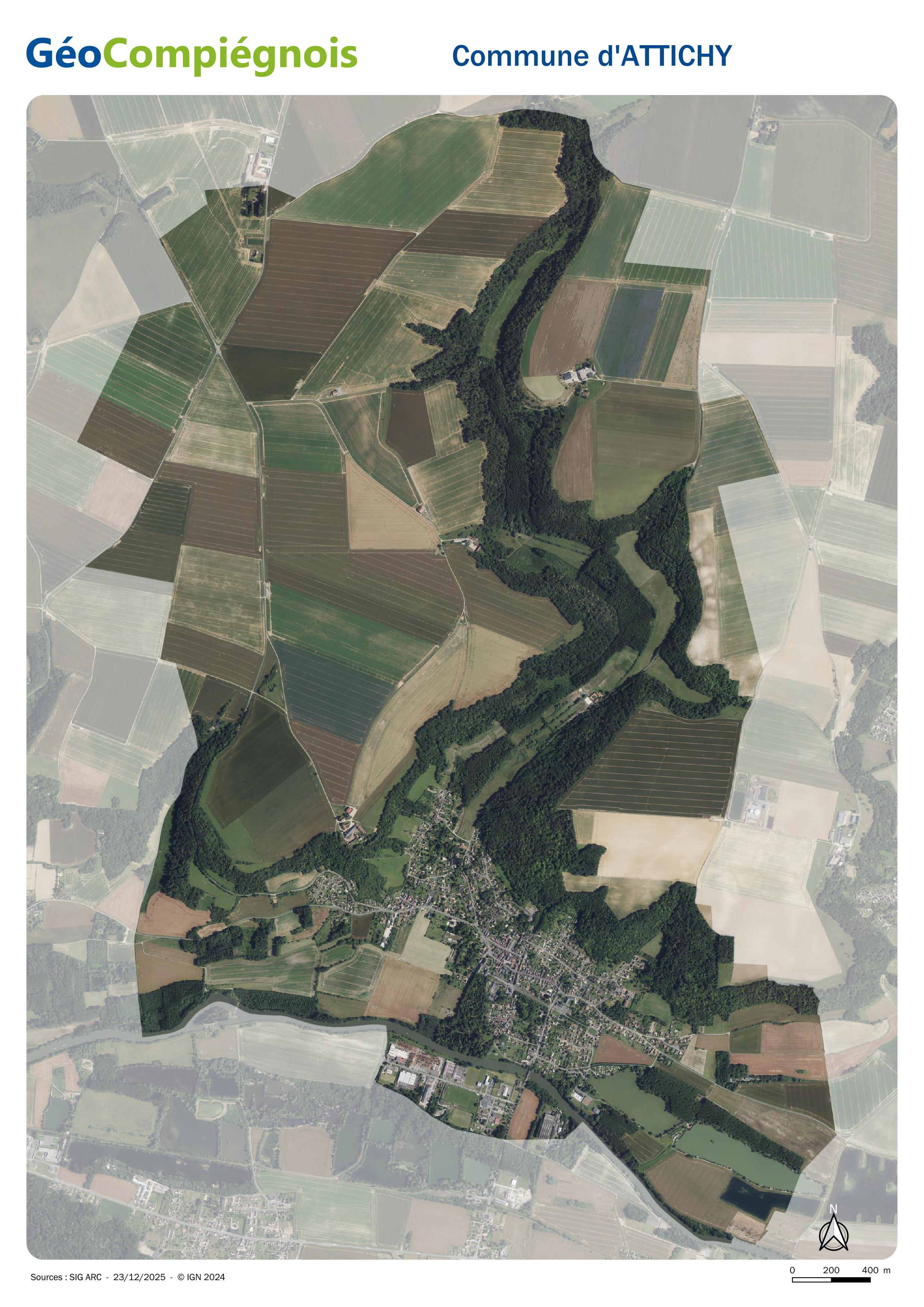
Photographie aérienne 2024 sur la commune d'Attichy
Orthophotoplan 2024 sur le territoire de la commune d'Attichy.
Simple
- Date (Creation)
- 2025-12-26
- Identifier
- 99898e2b-3f49-4ff2-bd73-9eb71fcceb93
- Status
- Completed
Publisher
GéoCompiégnois
-
Service Information Géographique
https://geo.compiegnois.fr/portail/index.php/nous-contacter/
Place de l'Hôtel de Ville
,
Compiègne
,
60200
,
FRANCE
03 44 85 44 74
https://geo.compiegnois.fr/portail/index.php/nous-contacter/
- Name
- JPEG
- Version
- Format A4
- Place
-
- Attichy
- Mots clés
-
- orthophotoplan
- commune
- Use limitation
- Utilisation libre sous réserve de mentionner la source (a minima le nom du producteur) et la date de sa dernière mise à jour
- Access constraints
- Copyright
Spatial resolution
No information provided.
- Denominator
- 20000
- Metadata language
- fre
- Character set
- UTF8
- Topic category
-
- Imagery base maps earth cover
- Description
- Attichy
N
S
E
W
))
- Reference system identifier
- EPSG / EPSG:2154 - EPSG:RGF93 / Lambert-93 / 7.4
- OnLine resource
-
Orthophotoplan 2024 de la commune d'Attichy (JPG)
(
WWW:LINK-1.0-http--link
)
Carte JPG de la commune d'Attichy au format A4
- Hierarchy level
- Map
Content Information
No information provided.
- File identifier
- 99898e2b-3f49-4ff2-bd73-9eb71fcceb93 XML
- Metadata language
- Français
- Character set
- UTF8
- Hierarchy level
- Map
- Date stamp
- 2025-12-26T12:00:39
- Metadata standard name
- ISO 19115:2003/19139
- Metadata standard version
- 1.0
Point of contact
GéoCompiégnois
-
Service Information Géographique
https://geo.compiegnois.fr/portail/index.php/nous-contacter/
Place de l'Hôtel de Ville
,
Compiègne
,
60200
,
FRANCE
03 44 85 44 74
https://geo.compiegnois.fr/portail/index.php/nous-contacter/
